
GEOGRAPHY
Kallooppara Grama Panchayat
Kallooppara Grama Panchayat is a rural local self-government institution situated under Mallappally Block Panchayat in Pathanamthitta District, Kerala. It is a region where the rich agricultural heritage and natural beauty of Central Travancore come together.
🌍 Geographical Location
- Located in the central part of Kerala.
- Situated near Mallappally town and Thiruvalla city.
- Well connected by road to major centers within the district and neighboring districts.
🌱 Topography and Natural Resources
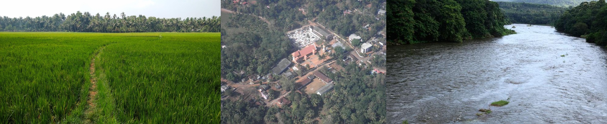
- The Panchayat comprises predominantly plains with a few gently elevated areas.
- Paddy fields, rubber plantations, and coconut groves are the prominent landscape features.
- Small streams and natural water resources support agriculture and water conservation.
🌦️ Climate
- The region experiences a tropical monsoon climate.
- It receives the Southwest Monsoon from June to September and the Northeast Monsoon during October and November.
- The temperature remains relatively moderate throughout the year.
🌾 Agricultural Importance
- Agriculture is the backbone of the local economy.
- Major crops include paddy, rubber, coconut, banana, and a variety of other agricultural products.
- Farming plays a vital role in the livelihood of the local community.
🌿 Biodiversity
- The Panchayat is home to a rich variety of trees, birds, and small wildlife.
- Its lush greenery and natural environment are among its distinctive features.
Summary
Kallooppara Grama Panchayat is a picturesque rural region that combines agricultural prosperity, abundant natural resources, and a rich cultural heritage. With its green landscapes and environmentally sustainable development potential, Kallooppara represents the traditional rural lifestyle and ecological richness of the Central Travancore region.ഫലിപ്പിക്കുന്ന പ്രദേശമായി കല്ലൂപ്പാറ അറിയപ്പെടുന്നു.